

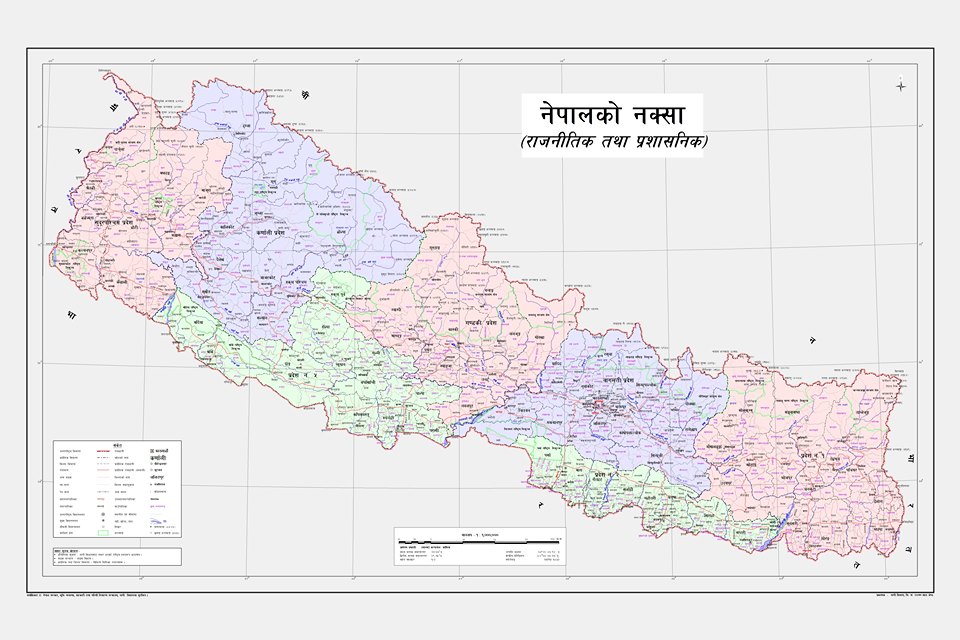
Kathmandu: The government of Nepal has published a revised political map of Nepal which incorporates Limpiyadhura, Lipulek and Kalapani in the far west as its part.
The Council of Ministers on May 18 had endorsed the updated map proposed by the Ministry of Land Management, Cooperatives and Poverty Alleviation.
Minister for Land Management, Cooperatives and Poverty Alleviation Padma Kumari Aryal released the map amidst a press meet at Singha Durbar today.
The map features Nepal’s northern, eastern, western and southern international border points and also political and administrative arrangements.
Now is to bring its coat of arms and logo into use as per the updated map. For the same, it is preparing to present a bill in the parliament, seeking an amendment to the constitution’s index.
The updated map integrates primarily Limpiyadhura, Lipulek and Kalapani area as Nepal’s territory and includes states and local levels as per the concept of federalism.
Last year, Indian government published a political map which showed the above areas in their territory. Recently, Indian Defense Minister Rajnath Singh inaugurated a road there constructed by Indian Border Construction.